 PDF Report (English)
観光が促進する地域文化資源の再構築と変容 /バンカ・ブリトゥン州の事例から
対象とする問題の概要 本研究の目的は、インドネシア錫鉱山地域における観光開発に着目し、観光開発を通して、地域文化がどのように再構築・変容され、地域の人々に理解されるようになってきたかを明らかにすることである。本研究の対象地であるバンカ・ブ…
Urbanization alters soil patterns, the flow of rainwater, and drainage systems, as well as the natural slope and gradient of the land. Rapid and unplanned urbanization disturbs catchment areas and their natural drainage features, which causes heavy run-off. Urban water bodies and wetlands are therefore not only significant sites for biodiversity, but they also act as sponges by soaking up excess water and recharging the ground water. With this background, the present study seeks to understand the discourse on urban ecology of the city in the context of urban water bodies and the impact of urban development.
Urban water bodies are not only surface water bodies but are also part of a complex network of urban ecology. The purpose of this research was to study the impact of urban growth of the city of Varanasi and map the existing water bodies and examine their restoration and improvement activities. Additionally, it is also important to explore the heritage restoration process of these ancient water bodies in urban ecology planning.
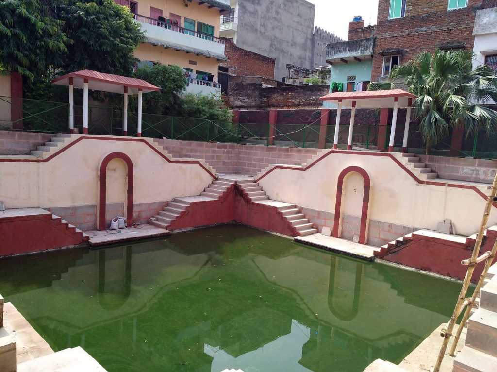
The research study in Varanasi was divided into two broad segments. In both parts I have referred primarily to the map of 1822 (prepared by James Prinsep) documenting the city’s temple tanks and ponds.
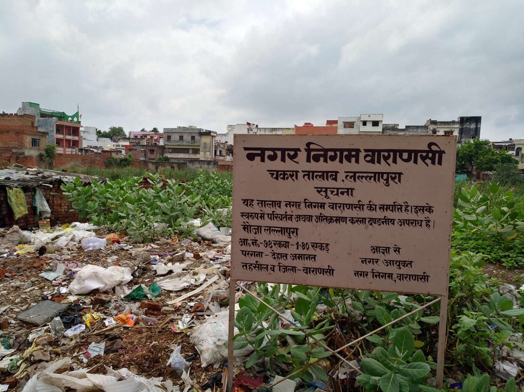
In the first segment, I revisited the existing temple tanks and ponds of Varanasi, documented their current status and discussed the ongoing restoration activities at a few temple tanks. In this study, I observed the significant revival and improvement of one ancient temple tank called Mātr̥ kuṇḍa, which was completely extinct and forgotten by many residents. Current restoration and revival programs are making considerable transformations in these temple tanks and ponds as well as in the boundaries, temple complex infrastructures, and access infrastructures of a few of the temple tanks. In the second segment of my study, I also started mapping the unnamed water bodies, which were either completely lost or encroached upon. The mapping of unnamed water bodies is a complicated exercise and requires advanced GIS mapping and comparison with the few satellite images we have of them. The mapping of unnamed water bodies also revealed the locations of a few unmapped water bodies known as Bhavanīya pōkharā.
Additionally, in this research project, I studied the ongoing restoration program and prospective revival plan of a few more temple tanks and ponds. Discussions with the staff members of the municipal office and members of INTACH as well as with citizens residing near these temple tanks and ponds also highlighted the inclusive understanding and expectations of the prospective revival program.
Research on the temple tanks and ponds of Varanasi needs regular fieldwork visits to document the transformation that is continuing within and around these water bodies. The topography and surroundings of the water bodies is changing considerably, so it is necessary to map these changes and study the impact of restoration activities. I plan to revisit these water bodies again next year and document their transformation and study the impact of heritage conservation on these heritage and water harvesting structures. I also plan to study the reclaiming of encroached upon and extinct temple tanks, particularly their restoration and reformation process. The study of these water bodies, which are known as sponges, is also another significant facet to explore in future research.
【1】Kelly, Eric Damian. 2010. Community Planning: An Introduction to the Comprehensive Plan. Washington, DC: Island Press.
【2】The Indian National Trust for Art and Cultural Heritage (Varanasi chapter)
Copyright © 附属次世代型アジア・アフリカ教育研究センター All Rights Reserved.